AgTech & Precision Farming
Drone-Based Crop Scouting: A Practical Guide to Getting Started in 2026
A working farmer's guide to using drones for crop scouting in 2026 — what platforms are worth buying, which imagery layers actually change decisions, and how to build a scouting workflow that saves real money.
Published July 18, 2026 · 12 min read
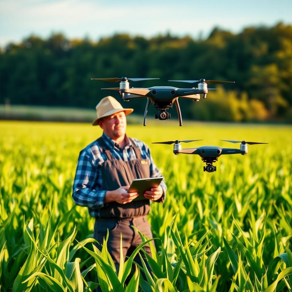
A drone will not save a farm that is not already scouting; it will make a scouting operation dramatically more efficient. That is the useful frame. The farms getting real value from UAVs in 2026 are the ones that already walked fields, already flagged pest hot spots, already made variable-rate decisions — and simply moved that work from foot to air. The farms that spent $6,000 on a drone hoping it would tell them what to do have mostly sold the drone.
What a drone actually changes about scouting
Four operational changes justify the equipment. Anything else a vendor promises should be treated skeptically.
- Coverage speed. A single foot-scouter walks 20–40 acres per day at any real level of attention. A drone covers 100–160 acres per hour at 30-meter altitude with a standard multispectral sensor. On a 400-acre operation, that turns a two-day walk into a two-hour flight.
- Pattern visibility. Standing in a field, you see one row. Flying over it, you see a heat map. Stress patterns tied to drainage, compaction, spray misses, planter skips and pest pressure become obvious in aerial imagery in a way they are simply not from the ground.
- Consistent record. Weekly geotagged imagery over a season becomes a farm-level dataset — variance from last year, response to a nitrogen sidedress, timing of a disease outbreak. Foot scouting almost never produces this.
- Reachable coverage. Fields you cannot easily walk in July (chest-high corn, wet ground, remote parcels) still fly.
The three platform tiers worth considering
Ignore the middle of the market. In 2026 there are three tiers that actually make sense.
Tier 1 — Consumer platform with a farm workflow layer ($1,800–$3,500). A DJI Mavic 3 Multispectral or a Mavic 3 Enterprise paired with a farm-management platform (DroneDeploy, Pix4Dfields, Solvi). Adequate multispectral for NDVI, NDRE and basic stand-count workflows. Reasonable flight time (35–40 minutes), simple training curve, and enough range for most quarter-section fields in a single battery. This is the right entry point for 90% of first-time farm buyers.
Tier 2 — Dedicated agricultural fixed-wing or hybrid ($8,000–$25,000). senseFly eBee AG, WingtraOne, Quantum-Systems Trinity. Covers 500–2,000 acres per flight, professional-grade multispectral or hyperspectral sensors, PPK/RTK positioning accurate to 2–3 cm. Justified on operations above roughly 1,500 acres, or in custom-scouting service businesses.
Tier 3 — Spray drones ($15,000–$45,000). DJI Agras T50, XAG P150 and similar. These are application platforms, not scouting drones. Only worth buying if you have a specific spot-spray or last-mile application use case — orchard understories, hillside vineyards, buffered field edges near waterways. Do not confuse them with the scouting purchase.
The Tier 2 category has a real trap: without a full-time technician, most farms cannot keep a $20,000 fixed-wing flying at capacity. Renting a Tier 2 flight from a custom operator two or three times a season is usually cheaper than owning one.
Sensors and imagery layers that matter
Imagery layers proliferate; four of them actually drive decisions.
- RGB (visible-light) orthomosaic. The base map. Every flight produces one. Useful for stand counts, weed patches, drainage patterns, spray-boom misses and physical damage.
- NDVI (Normalized Difference Vegetation Index). Ratio of near-infrared to red reflectance. Rough indicator of green biomass and general crop vigor. Best for early-season stand assessment and late-season senescence patterns. Saturates in mid-season when canopy closes — it stops discriminating between "healthy" and "very healthy."
- NDRE (Normalized Difference Red Edge). Uses red-edge instead of red reflectance. Does not saturate the way NDVI does; discriminates nitrogen status and mid-season stress far more reliably. If your sensor supports it, NDRE is the more useful mid-season layer.
- Thermal. A separate sensor, roughly doubling drone cost. Detects water-stress patterns before they show in visible imagery. Justified on irrigated high-value crops (specialty vegetables, orchards, vineyards); rarely justified on dryland row crops.
Hyperspectral, LiDAR and other specialty sensors have narrow, real use cases but should never be a first purchase.
The legal setup — Part 107, waivers, insurance
For commercial operation of a drone under 55 lb in the United States you need three things:
- FAA Part 107 Remote Pilot Certificate. A single knowledge test at a testing center. Study time: 15–30 hours. Fee: $175. Valid indefinitely with online recurrent training every 24 months. This is the license.
- Aircraft registration. Every drone over 250 grams used commercially must be registered with the FAA. $5, renewed every 3 years.
- Liability insurance. Farm bureau and specialty ag drone policies (SkyWatch, Avion) offer $1M liability policies for $500–$1,500 per year. Most farms already carry a general farm liability policy; check whether it covers UAV operations before buying separately.
Fly-over-people waivers and beyond-visual-line-of-sight (BVLOS) operations require separate FAA authorization and are not needed for standard field scouting. Fly during daylight, keep the drone in visual line of sight, stay under 400 feet AGL, and you are inside standard Part 107.
A weekly scouting workflow that actually gets done
The single biggest predictor of whether a farm keeps using its drone in year two is whether the scouting workflow fits into a real week. A design that gets done:
- Fixed weekly flight window — the same morning each week during the growing season, weather permitting. Consistency is worth more than optimal timing.
- Pre-planned flight missions in your platform (DroneDeploy, Pix4Dfields). One tap in the field launches the mission; the drone flies, lands, and uploads on its own.
- Same-day imagery review — 30 minutes reviewing NDVI/NDRE layers on the tablet before the field is stale in your mind.
- Ground-truth the anomalies. The drone finds patterns; you walk the flagged spots to see whether it is aphids, drainage, planter skip or nutrient. The drone does not diagnose; it directs your feet.
- Log the decision. If the flight changes anything — a targeted spray, a variable-rate sidedress, a decision to hold off — write it down against that field. That log is where the ROI comes from.
The five decisions drones make cheaper
- Replant decisions. Post-emergence stand count on a 200-acre field in one flight tells you whether a section is under threshold — saving both the cost of replanting where it is unnecessary and the yield loss where it is warranted.
- Sidedress rates. NDRE zones drive variable-rate nitrogen prescriptions that typically save 15–25 lb/acre of N on parts of the field that do not need it.
- Fungicide timing and coverage. Early stress patterns in NDRE often precede visible disease by 5–10 days, and post-spray imagery confirms whether the boom actually covered the field.
- Irrigation scheduling. Thermal imagery on irrigated ground catches water-stress patterns before visible wilt, and identifies specific pivot spans or drip zones that are underperforming.
- Insurance and cost-share documentation. Time-stamped aerial imagery of storm damage, prevented planting, or NRCS practice implementation shortens claims and audits from weeks to days.
What the ROI actually looks like
A working row-crop farm of 800 acres running a Tier 1 setup ($3,000 drone + $1,500/year software) typically recovers the annual cost from a single decision — one avoided full-field replant, one N sidedress saved on 200 acres, one confirmed spray coverage catching a boom fault. The equipment cost usually pays back in year one. In years two and beyond, the farm is essentially paying $1,500 annually for a scouting capability that would cost $6,000–$12,000 in labor to replicate on foot.
Custom-flying a Tier 2 rig as a service business runs $6–$12 per acre depending on region and imagery deliverables, with a break-even around 1,500–2,500 acres flown per year. That side business is a real one for skilled operators in row-crop regions; it is not a hobby that scales itself.
Key takeaways
- ◆A drone amplifies existing scouting discipline; it does not create it. Farms that were not scouting on foot rarely start scouting from the air.
- ◆The Tier 1 consumer-plus-farm-platform combination ($1,800–$3,500) fits 90% of first-time buyers; Tier 2 fixed-wings are usually cheaper to rent than own.
- ◆NDVI is useful early and late in the season; NDRE is the more reliable mid-season stress and nitrogen indicator on most row crops.
- ◆Part 107 certification, aircraft registration and $1M liability coverage are the full legal stack for standard commercial farm operations.
- ◆A weekly, repeatable flight-and-review workflow is the single biggest predictor of whether a farm still uses its drone in year two.
Frequently asked questions
Do I need to know how to fly a drone before buying one?+
No. Modern consumer platforms fly themselves once the mission is uploaded — take-off, mapping pattern, landing and return-to-home are automatic. Learning to interpret imagery takes more effort than learning to fly. Budget 10–20 hours to get comfortable with your platform's software; the flying itself is straightforward.
Can I scout at night or in cloudy weather?+
Night flying requires a Part 107 waiver and appropriate lighting on the drone. Cloudy weather is fine for RGB imagery but degrades multispectral quality; overcast to lightly cloudy conditions produce the most consistent NDVI and NDRE layers, ironically better than harsh direct sun which creates strong shadows and reflectance variance.
How does drone imagery compare to satellite imagery for scouting?+
Satellite services (Planet, Sentinel) cover any field for free or cheap, but resolution is 3–10 meters per pixel and revisit is weekly at best in clear weather. Drone imagery runs 2–5 centimeters per pixel and flies when you decide. For big-picture regional monitoring, satellite is fine. For pattern detection inside a specific field, drone imagery reveals things satellite cannot see.
Is it worth learning to process imagery myself, or should I use a service?+
For a single-farm operation, a subscription platform (DroneDeploy, Pix4Dfields, Solvi) is almost always the right answer — processing takes minutes rather than hours and outputs are in shapefile formats your equipment already uses. Learning full photogrammetry processing only pays off if you are running a custom-scouting business and want to control every step of the pipeline.
Keywords
- drone crop scouting
- agricultural drone
- ndvi imagery farming
- precision agriculture drone
- farm uav workflow
Related reading
AgTech & Precision Farming
Controlled Environment Agriculture: The Real Economics of Greenhouses and Vertical Farms in 2026
A grower-oriented look at what greenhouses, high tunnels and vertical farms actually cost to build and run, which crops pencil out, and where the CEA industry is heading after the 2022–2024 shakeout.
July 17, 2026 · 13 min read
AgTech & Precision Farming
Precision Agriculture: A Getting-Started Guide for Working Farms
A practical, working-farm introduction to precision agriculture — what tools actually change decisions on the ground, and which ones are still marketing.
July 8, 2026 · 10 min read
AgTech & Precision Farming
Smart Irrigation for Small Farms: Systems That Pay Back
Drip, sensors, and scheduling that actually work on 1–20 acres. Real system designs, costs, and the metrics that decide whether the investment pays for itself.
June 18, 2026 · 9 min read